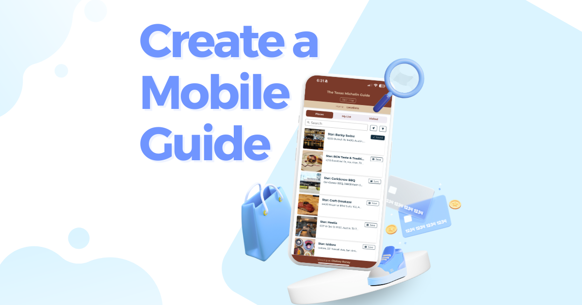
If you’re already offering self-guided walking tours on paper — you’re doing a great thing for your community. Visitors love the freedom to explore at their own pace with a guide in hand.
Now imagine if you could make those tours more interactive, up-to-date, and accessible on every visitor’s phone — without replacing your beloved brochures. That’s where Proxi’s self-guided digital tour maps shine.
Why Build Your Walking Tour with Proxi?
Creating a walking tour map with Proxi is fast, flexible, and made for busy teams like yours. Think of it as the Canva of map making — approachable, easy to use, and designed for people without tech, design, or GIS experience.
If you can drag and drop, you can build an incredible map with Proxi. Here’s what makes it stand out:
✅ Ridiculously Easy to Build
No coding, no complicated software. You can build and publish a beautiful, professional-looking map in just minutes. Add points, descriptions, and images with just a few clicks — it’s simple enough for anyone on your team to use.
🎨 Fully Brandable
Your digital tour map should feel like yours. Proxi lets you customize your map’s look and feel to match your existing brochures, signage, and marketing materials.
- Add your logo
- Choose your brand colors and fonts
- Customize icons and point markers
📸 Tell a Better Story with Multimedia
A paper map can only go so far — but a Proxi map brings your story to life. At every stop, you can add:
- Photos and image galleries to showcase your sites
- Audio narration, local voices, or background music to set the mood
- Video clips or historical footage for added depth and context
- Links to tickets, blogs, menus, or event pages so people can act in the moment
It transforms a simple walking tour into an interactive, story-driven adventure — and you control the narrative.
📊 Insightful, Actionable Analytics
One of the biggest advantages of a digital map is knowing how people actually use it — something paper maps can’t tell you. With Proxi, you get real-time insights into how visitors are interacting with your walking tour.
Track key stats like:
- Total map views — see how many people are opening your tour
- Point clicks — find out which stops are getting the most attention
Check-ins — discover where people are visiting in person
Why it matters:
This data helps you identify what’s popular, understand visitor patterns, and make smart updates to your tour over time. You can feature high-interest stops, adjust underperforming ones, and continually improve the experience — keeping your tour fresh, relevant, and visitor-friendly.
With Proxi, your tour doesn’t just look good — it performs better too.
📱 Easy to Share
Once your map is built, sharing it is effortless. Digital maps can go places paper maps simply can’t — making it more convenient for visitors and easier for your team to promote. You can easily distribute and share your tour through:
- Direct links
- Custom QR codes
- Email newsletters
- Social media posts
🖨️ Print-Friendly Options
Need to keep a printed version? No problem — you can export your digital tour into a clean, printable format. It’s the perfect hybrid solution when you need both paper and digital working together.
Keep It Updated, Without Reprinting
One of the biggest headaches of paper maps is how quickly they become outdated. New businesses open, exhibits change, and hours shift — and every time, it means a reprint.
With Proxi, you can edit your map anytime. Update stop details, swap out images, change hours, or add new points of interest on the fly.
No reprints. No delays. No wasted brochures. Your walking tour stays current, which means your visitors always get the best possible experience.
A Smart Companion to Your Paper Maps
Proxi isn’t here to replace your printed maps — it’s designed to enhance them.
Simply add a QR code or short link to your paper brochures, visitor center displays, or signage. When visitors scan or click, they’ll be taken directly to your interactive digital map, loaded with extra features and rich content you just can’t squeeze onto paper.
Why pair them?
- Visitors can choose their preferred format
- Digital maps offer multimedia, links, and live updates
- No need to constantly reprint materials
- Creates a modern, connected experience without extra staffing
It’s an easy, affordable upgrade that makes a big impact.
Pro-Tip: Turn It Into a Passport Challenge
Want to boost engagement even more? Turn your self-guided tour into a passport-style challenge using Proxi’s check-in feature.
Visitors can digitally “check in” at each stop, collect stamps, and earn prizes — just like a paper passport, but easier to manage and even more fun.
Why gamify it?
- Increases participation and time spent in your area
- Encourages visitors to explore more stops
- Simplifies prize tracking and fulfillment
Perfect for events, art walks, scavenger hunts, brewery trails, and seasonal promotions It’s a simple add-on that turns your map into an experience people will talk about and share.
The Bottom Line: Make Your Map Work Harder
Adding a Proxi self-guided walking tour to your paper maps is one of the easiest, smartest ways to increase tourism, modernize your visitor experience, and tell your story better.
It’s fast, affordable, and built for community organizations like yours. With the ability to update, customize, and track everything in one place, it’s a powerful tool that makes your job easier — and your guests’ experiences better.
Ready to upgrade your walking tours?
Related Articles
Get Inspired
View All Featured MapsAdventure Awaits!
Check out some of the latest articles on our blog


.png)
.png)
